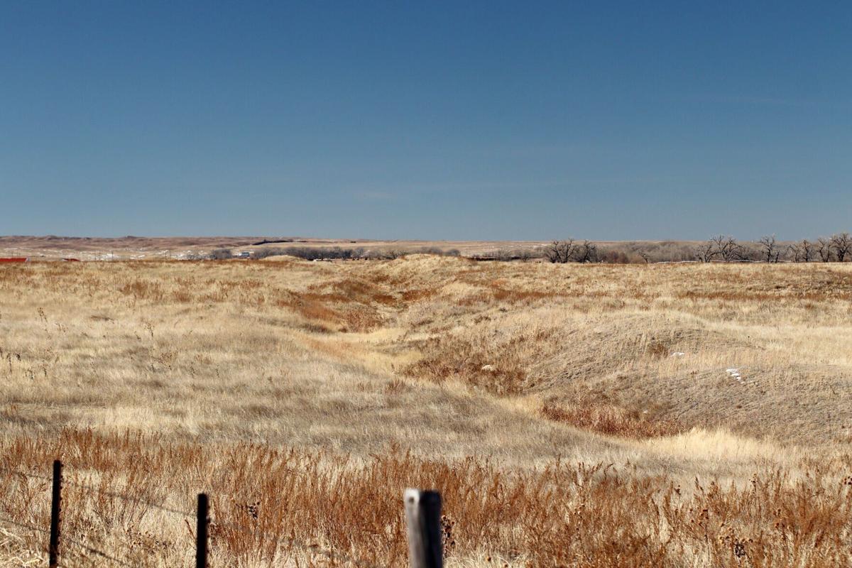
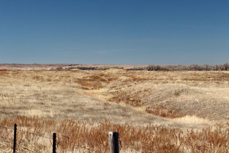
Remnants of the aborted 1894 Perkins County Canal can be seen running through the middle of this photo about five miles southeast of Ovid, Colorado. Some 600 drought-stricken settlers crossed the state line into Sedgwick County and personally dug about 16 miles of an intended 65-mile canal before their financing collapsed. Nebraska Gov. Pete Ricketts now wants to invoke the state’s 1923 South Platte River Compact with Colorado, which gave Nebraska the right to revive and finish the canal.
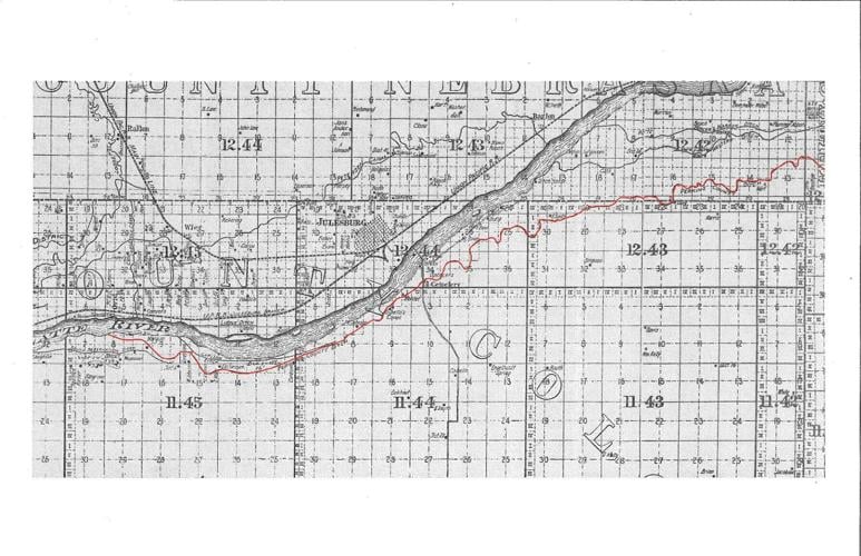
The intended path of the partly finished Perkins County Canal can be seen in this 1902 map of Sedgwick County, Colorado’s northeasternmost county next to Nebraska. The 16 miles dug out in 1894 left the South Platte River south and just west of Ovid. The southernmost weaving line below the river shows the intended route, which passed north of the still-existing Julesburg Cemetery and then ran more or less east to the Nebraska line. Construction stopped somewhere east of the cemetery. Present-day County Road 28 and Interstate 76 generally parallel the canal’s visible remnants, with I-76 apparently crossing the canal’s path at the U.S. Highway 385 interchange at Julesburg.
Mark Burke C.E. Julesburg Colorado (1902); The Papers of Delph E. Carpenter, Colorado State University, via Twin Platte Natural Resources District
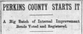
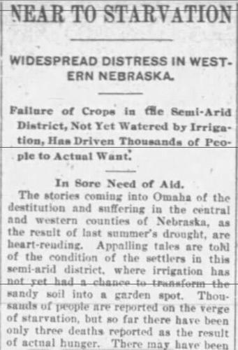
Above: A clipping from a Sept. 18, 1894, article in the Nebraska State Journal shares what at that time seems to be good news — Perkins County residents were set to begin work on the 65-mile-long ditch that began in Ovid, Colorado. State Auditor Eugene Moore had registered $90,000 worth of irrigation bonds, according to the article.
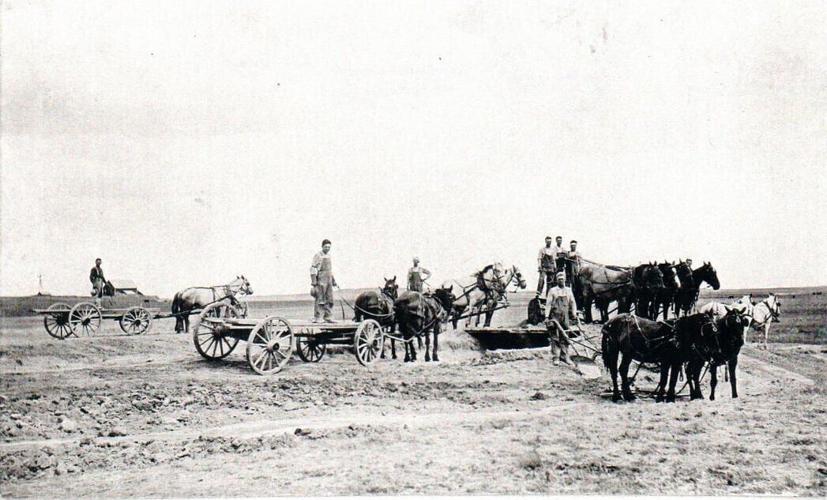
Some of the approximately 600 early Perkins County residents who worked on their county’s ill-fated South Platte River irrigation canal pause during their fall 1894 construction work in Sedgwick County, Colorado. They included William John Hoffman, Emil Gephart, C.J. Pankonin, Otto Pankonin and Morg Stevens.
In this clipping from the Jan. 3, 1895 edition of the Blair Weekly Telegram, it’s become clear that the Perkins County Canal did not go according to plan: “(T)he farmers who did this work upon the ditch are a great deal worse off than if they had not gone out there at all.”
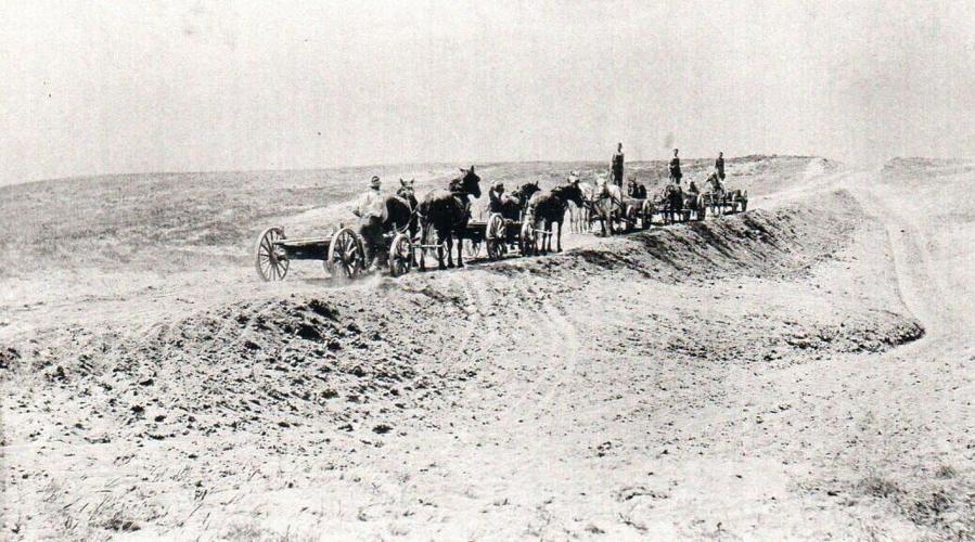
Horses and wagons pass each other on a primitive road in Sedgwick County, Colorado, during the original fall 1894 digging work for an intended 65-mile-long irrigation canal across the Nebraska line and into Perkins County. The road’s cut into a hill in the right background resembles an eroded cut and built-up embankment visible between County Road 28 and Interstate 76 between the interstate’s Ovid and Julesburg exits.
Remnants of the aborted 1894 Perkins County Canal can be seen running through the middle of this photo about five miles southeast of Ovid, Colorado. Some 600 drought-stricken settlers crossed the state line into Sedgwick County and personally dug about 16 miles of an intended 65-mile canal before their financing collapsed. Nebraska Gov. Pete Ricketts now wants to invoke the state’s 1923 South Platte River Compact with Colorado, which gave Nebraska the right to revive and finish the canal.
The intended path of the partly finished Perkins County Canal can be seen in this 1902 map of Sedgwick County, Colorado’s northeasternmost county next to Nebraska. The 16 miles dug out in 1894 left the South Platte River south and just west of Ovid. The southernmost weaving line below the river shows the intended route, which passed north of the still-existing Julesburg Cemetery and then ran more or less east to the Nebraska line. Construction stopped somewhere east of the cemetery. Present-day County Road 28 and Interstate 76 generally parallel the canal’s visible remnants, with I-76 apparently crossing the canal’s path at the U.S. Highway 385 interchange at Julesburg.
Mark Burke C.E. Julesburg Colorado (1902); The Papers of Delph E. Carpenter, Colorado State University, via Twin Platte Natural Resources District
Above: A clipping from a Sept. 18, 1894, article in the Nebraska State Journal shares what at that time seems to be good news — Perkins County residents were set to begin work on the 65-mile-long ditch that began in Ovid, Colorado. State Auditor Eugene Moore had registered $90,000 worth of irrigation bonds, according to the article.
In this clipping from the Jan. 3, 1895 edition of the Blair Weekly Telegram, it’s become clear that the Perkins County Canal did not go according to plan: “(T)he farmers who did this work upon the ditch are a great deal worse off than if they had not gone out there at all.”
Some of the approximately 600 early Perkins County residents who worked on their county’s ill-fated South Platte River irrigation canal pause during their fall 1894 construction work in Sedgwick County, Colorado. They included William John Hoffman, Emil Gephart, C.J. Pankonin, Otto Pankonin and Morg Stevens.
Horses and wagons pass each other on a primitive road in Sedgwick County, Colorado, during the original fall 1894 digging work for an intended 65-mile-long irrigation canal across the Nebraska line and into Perkins County. The road’s cut into a hill in the right background resembles an eroded cut and built-up embankment visible between County Road 28 and Interstate 76 between the interstate’s Ovid and Julesburg exits.