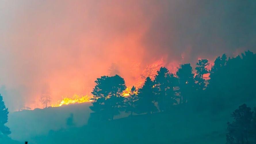
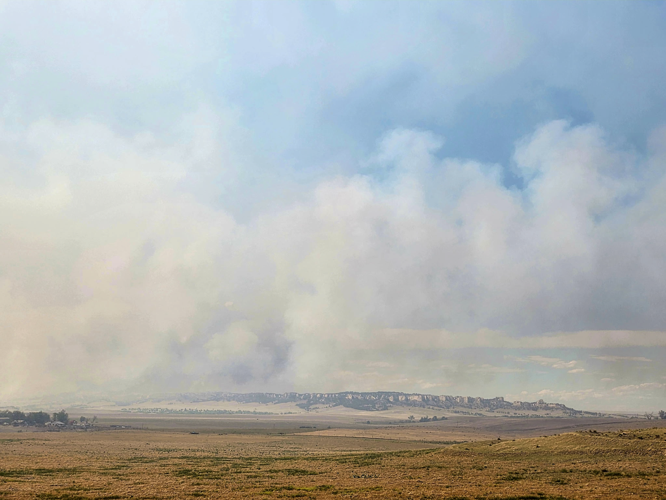
Photographer Roger Meisinger captured the South Fork Fire near a lookout on Highway 20 Tuesday night. By Wednesday morning, the fire is reported to have burned nearly 9,000 acres.
kAm#68:@? ab t>6C86?4J |2?286CD 92G6 :DDF65 E96 7@==@H:?8 ?@E:46ik^Am
Evacuations are underway as ordered by local law enforcement in the an area immediately north of Crawford city center to include the area South of Dodd Road, west of Dodd Road, and FF street. Fort Robinson State Park has also been evacuated until further notice.
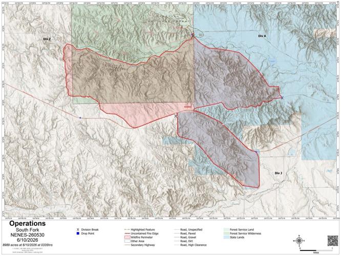
The current fire map of South Fork Fire as of the afternoon of June 10.
Courtesy
The South Fork Fire burns within Fort Robinson State Park boundaries. The park is closed until further notice for public safety and to support firefighting efforts.
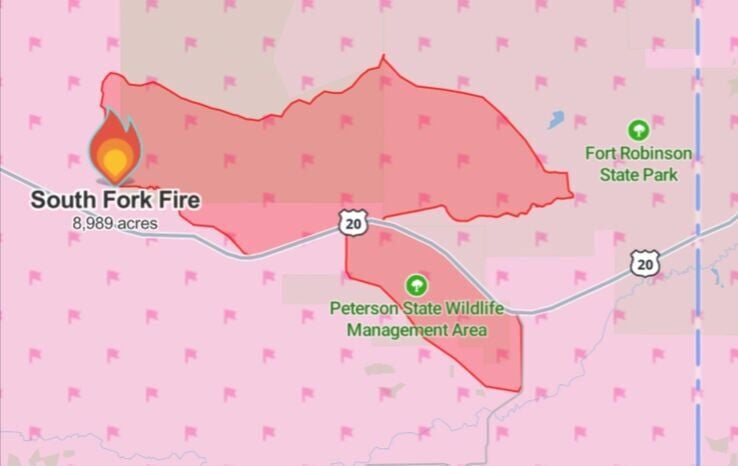
The South Fork Fire near Crawford is reported to have burned 8,989 acres. The fire has now moved into Fort Robinson State Park and is burning within the Soldier Creek Wilderness and Peterson Wildlife Management Area.
Photographer Roger Meisinger captured the South Fork Fire near a lookout on Highway 20 Tuesday night. By Wednesday morning, the fire is reported to have burned nearly 9,000 acres.
The South Fork Fire near Crawford is reported to have burned 8,989 acres. The fire has now moved into Fort Robinson State Park and is burning within the Soldier Creek Wilderness and Peterson Wildlife Management Area.
Evacuations are underway as ordered by local law enforcement in the an area immediately north of Crawford city center to include the area South of Dodd Road, west of Dodd Road, and FF street. Fort Robinson State Park has also been evacuated until further notice.
The South Fork Fire burns within Fort Robinson State Park boundaries. The park is closed until further notice for public safety and to support firefighting efforts.